About the Trek
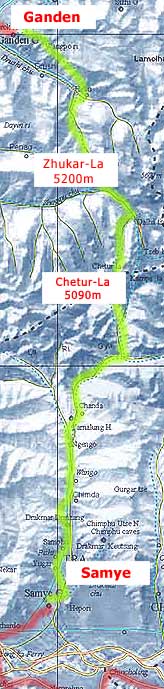
Our Trek starts about 45 km NE of Lhasa and connects two historical monasteries: Ganden in the north and Samye in the south. The latter is the cradle of Tibetan Buddhism - it was here, where in 755 AD after a two-year scholars’ debate Buddhism was made the state religion of Tibet.
Before we reach our destination though we have to cross two side chains of the Himalayas conquering two high passes over 5,000m: Zhukar-La at 5200m and Chetur-La at 5090m.
In the middle of it we'll be 2-days walk away from any civilization,
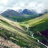
just surrounded by 20,000 ft (6,000m) snowy peaks,
rushing rivers and green valleys.
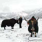
We'll use yaks to carry our tents and heavy luggage and will be
accompanied by the local guides. At the end of the
trek we'll have to
cross
the mighty Brahmaputra river by ferry, which takes 2 hours! We'll
walk through a varied terrain from barren plateaus and scree to
lush valleys and willow groves.
We'll camp with our yaks and shepherds under star-studded skies of
the roof of the world...
The weather may be unpredictable and altitude sickness is always a possibility.
All of us trained hard to meet the challenge. Find out more about my training
routine here.
If you are visiting this page in after 1 June 2005 please check the 'Trek Tibet Report' page for pictures and my impressions.
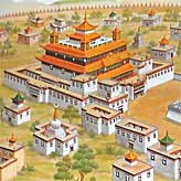
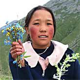
Picture credits: The
top three photos on this page are courtesy of Andy Smith who
did the trek with a group of friends in Summer 2004. The last picture
is
the contemporary
painting of the Samye Monastery reproduced from a book "Tibet
- Turning the Wheel of Life" published by Thames & Hudson
(ISBN 0-500-30112-3). The trek map on the right has been derived
from map No. 2991 published
by the Tibet Map Institute in France (www.tibetmap.com).